
Trace a Willmar Street by Address
Start the address trail with a single full address, not a loose street name. Kandiyohi GIS is the county's address and parcel context tool. It can show the property record, plat, city-limit layer, roads, and other geography before a document request is made. A street result can help identify a parcel and a recorded-document question. It cannot establish current household membership on its own.
Keep the address normalized all the way through the search. A directional, a road-versus-street suffix, or a unit can change a match. Also save the parcel ID and legal description, because older deeds may use lot, block, plat, section, township, and range rather than a modern street number. The following sequence keeps each record in its proper role.
- Search the address in Kandiyohi GIS, then record the displayed address, parcel ID, plat, lot or block, legal-location elements, and viewer update date.
- Turn on city limits and plat layers to separate the postal name from municipal geography and to check whether the parcel sits in a platted area.
- Use the Recorder's party-name, date, and legal-description search concepts to locate a recorded-document lead, then obtain the important deed image or county copy.
- For voter information, use the statutory public-list request and required certification when a permitted record question exists. MNVotes confirms a registration match but does not browse a street.
- For an earlier address snapshot, request a historical criss-cross or city-directory search, or check newspapers with the street, date window, and name variant.
For a separate one-person verification workflow, use the Willmar Resident Lookup rather than turning a street record into a personal roster.
Willmar Street Directory Search Fields
The Kandiyohi GIS search selector supports Parcel Number, Address, Plat Name, and Section. Its public mailing REST service exposes a useful field vocabulary for an address-oriented search. Field names are abbreviated, and the county did not publish a complete assessor-card field inventory in the reviewed materials. Treat the REST schema as a map and property data layer, not a claim that every viewer label or ownership field is stable.
| GIS field or control | Street-directory use |
|---|---|
| Address search | Start with the full property address and preserve the number, directional, road name, suffix, and any secondary-address detail. |
PROPHSENUM, PROPDIR, PROPROAD | House-number, directional, and property-road components from the public mailing layer. |
PROPZIP | Property ZIP attribute, useful for comparison with USPS but not a complete postal-boundary proof. |
PARCELCPI | Parcel identifier used to reconnect the map result with deed, permit, and tax questions. |
PLATNAME, PLATNO, LOTNO, BLOCKNO | Platted-property clues that may bridge the map and an older legal description. |
SECT, TWP, RNG | Section, township, and range elements for non-platted legal descriptions. |
Split and SplitNote | Current parcel-split context, which can explain why an older instrument does not use today's parcel ID. |
The county's Public Mailing Kandi REST fields provide the source view for those labels.
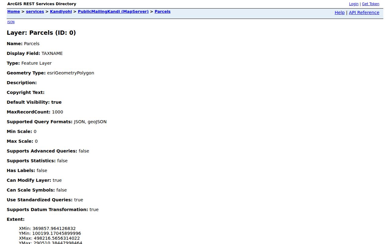
The field display makes clear why it is safer to preserve a source label than to rename a value as owner, resident, or physical address without an explicit county label.
Willmar Street and Parcel Roles
An address can appear in several county systems with different meanings. A situs address is the physical property address used by maps and many permits. A mailing address belongs to tax or public-mailing context. A legal description identifies land in a deed or plat. A recorded grantee is a party to an instrument. These roles may line up, but the research does not support treating them as interchangeable.
- Situs address
- The physical location used to find a parcel in GIS and to identify many permit files.
- Parcel
- A current county map identifier. It can change or split, so an older deed may need to be followed by legal description.
- Plat
- A recorded map of a subdivision or addition that can show lot, block, and subdivision context.
- Criss-cross directory
- A historical address-arranged directory, when an edition includes one, used to compare a dated household listing by street.
The map also offers city limits, voter districts, school districts, zoning, flood zones, public-land survey, roads, aerials, and other layers. Use them one at a time. A street may cross a municipal or township boundary even when its mailing name says Willmar.
Willmar Street Records by Custodian
A good Willmar street directory sequence compares records keyed to the address, parcel, or legal description. Some are open in a viewer, some are accessed through paid remote search or public office computers, and some require a focused request. The coverage below separates the result type from the access channel. It does not convert a property or document record into a current occupancy record.
| Address-keyed record | Willmar keeper | What it can show | Access channel |
|---|---|---|---|
| GIS parcel and address layer | Kandiyohi GIS / Surveyor | Parcel geometry, address, plat, boundaries, aerial and dated mailing or tax context | Public GIS viewer and REST service |
| Recorder index and image | Kandiyohi County Recorder | Recorded parties, document number or type, date, legal-description and image lead | Office computers, Tapestry EON, Laredo, or copy request |
| Tax statement context | Auditor/Treasurer | Tax year, parcel, and payment or mailing association where shown | Statement route and office contact; payment form is not an ownership search |
| Plat or subdivision record | GIS / Recorder | Plat name, folder, lot, block, boundary, and split context | GIS plat layer or Plat Search; request image when needed |
| Building or septic packet | Environmental Services | Project, plans, site plan, permit packet, or septic history | Email, mail, in-person, fax, or dropbox request by address or parcel |
| Historical directory or newspaper | KCHS, library, or MNHS | Dated household, address, notice, or event clue | Collection inquiry, staff request, or digitized newspaper search |
Note: A permit or tax entry is a project or tax-period record, not proof of who occupied a property at another time.
Willmar Street Plat Checks
Use the plat before assuming that a current parcel number carries through an older deed. Kandiyohi GIS explains that a partial plat-name search may work. With the Plat layer active, clicking a platted area can show an abbreviated name and a popup with the full plat name and folder number. The View Plat control opens the image or map, and underlying plats can be toggled for more context.
This is a local address-search advantage. A plat can explain why a street number is absent from an older document, why a parcel is now split, or which lot and block belong to the same legal description. It cannot prove current residence or replace the Recorder's legal-description search. Record the plat name, folder number, parcel ID, and the map's date before moving to the deed trail.
Use Kandiyohi Plat Search or the GIS Plat layer for the starting map context. The research did not capture a live result sample, so check the current control labels before relying on a particular popup behavior.
Willmar Street Deed Trail
The Recorder's real-estate route has three distinct channels: public office computers, Tapestry EON for remote paid searching, and Laredo for professional subscribers. Tapestry is described by the county as supporting party-name, date, legal-description, and other search concepts. The county says a single Tapestry search can return up to 200 listings, but the reviewed material does not publish an index start or end date. A blank result therefore may point to coverage, query, or record-type limits.
Search the current parcel's legal description as well as a party name. When a recorded document is important, capture the document number, type, recording date, named party role, legal description, search date, and image or copy route. Then compare the image with the GIS plat and split context. A popup link from a parcel is a convenience list, not a complete search of all documents affecting that property.
The Recorder's access page for Tapestry and Laredo shows the county's documented channels.
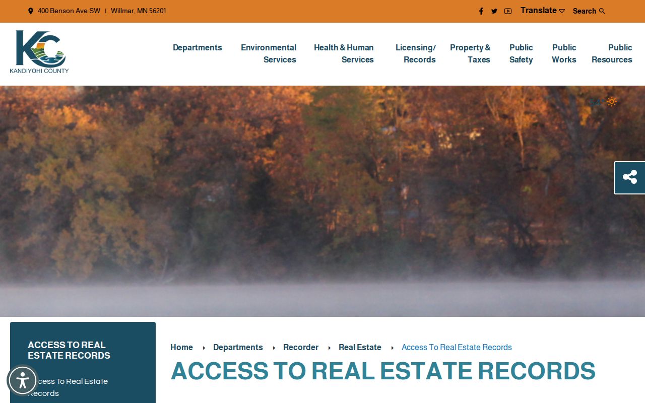
The county access screen distinguishes a remote search from the office-computer route, which matters when a street-directory search needs the actual document rather than an index lead.
The remote Tapestry EON entry is the linked paid search destination.
Remote access can locate a listing, but the legal description and image review remain the checks that tie a document back to the mapped street address.
Willmar Street Permit and Septic Requests
Environmental Services is the verified county route for building packets, plans, site plans, and septic records. A request by email should include the property address or parcel ID, project description, and phone number. The office accepts permit requests in person, by mail, email, fax, or dropbox. Inspection requests require 24 hours' notice. No public county listing of issued permits was located in the research.
For most properties, the county says septic records go back to 1972 when the requester provides the tax parcel, address, or legal description. That is a useful address-history lead, yet it documents a septic record or project context, not a household. Send a specific question to Environmental Services building permits and save any reply with the parcel and record type.
City packets, zoning actions, plats, and public-works records may also explain an address or boundary change. A complete current City of Willmar permit index was not verified, so use the named custodian and precise date range under Minn. Stat. §13.03 when an online record is absent.
Willmar Street ZIP Boundaries
Willmar is listed with Kandiyohi County and ZIP 56201 in Minnesota's official city, county, and ZIP document. The research did not find an official source that establishes every address in the delivery area or every additional ZIP that may use a Willmar mailing name. A ZIP result should be kept separate from the city-limit layer. Postal geography and municipal geography often answer different questions.
Use USPS ZIP Lookup to verify address syntax. USPS offers address, city-and-state, and ZIP modes and warns that a ZIP response does not confirm a person or company at an address. Then compare the address with Kandiyohi GIS city limits and the property PROPZIP field. If the postal response and county layer differ, record both and ask the responsible office rather than silently correcting a result.
Willmar Street Directories in Time
Historical directories can add a dated household or address clue to a Willmar street directory search. MNHS says city directories are usually organized by head of household, while telephone books are organized by county. An edition may include a name, address, household notation, and sometimes an occupation or business detail, but the exact fields vary. A not-found result may mean the person was not the head of household, the year is missing, the address lay outside the city, or the collection is incomplete.
The Minnesota Historical Society offers a paid request that searches one person or business in up to five years. The listed choices are city directory, telephone, or both, with listed $10, $10, and $20 options including the stated $5 processing amount. Usual timing is three to four weeks and can extend to 12 weeks. Keep the request focused on the street, name spelling, and chosen years. The Willmar City Directory contains the fuller collection trail and repository questions.
For newspaper support, the Minnesota Digital Newspaper Hub has Willmar Tribune, Weekly Tribune, Argus, Journal, Republican, Republican-Gazette, and Wilohi title leads. Search a street with a surname and preserve the issue date and page. OCR can miss hyphens, initials, and Scandinavian spellings.
Willmar Street Sanborn Context
Sanborn fire-insurance sheets can place a historical address within a building, block, or street setting. Minnesota Historical Society material identifies Willmar sheets from 1893, 1899, 1909, 1914, 1925, and 1931, with a later 1931 to October 1946 lead. The sheets can show building footprint, use, and street layout. They are not a current parcel map and do not identify a present household.
Pair a map sheet date with a directory edition, newspaper page, or deed image. That keeps the block context tied to a period instead of making an unsupported continuous-residence claim. Current aerial imagery can help visualize change, but the county lists Pictometry flights as observational imagery, not a deed, legal boundary survey, or occupancy record.
Note: Preserve the Sanborn year and sheet reference, because the same street can look materially different across editions.
Willmar Street Directory Limits
A Willmar street directory search can reveal address-linked public records, but it has clear limits. GIS shows map and parcel context. A tax or mailing field reflects a dated system association. A deed index identifies a recorded party and document lead. A directory places a household in an edition. None alone proves who is at an address today, establishes a social relationship, or resolves two people with the same name.
Minnesota Safe at Home protects participant addresses through a designated mailing route. When an address is missing, do not try to reconstruct it from relatives, adjacent parcels, or map proximity. Protected voter and other classified data have their own limits. The Safe at Home program information explains the official protection without exposing participant locations.